Outdoor Navigation Guide & Map Skills (Beginner)
Fundamentals: Building Blocks
The Basics Matter: Learning From Getting Lost
My first serious navigation lesson came from getting lost in the Kenyan bush at night. The terrain looked completely different in darkness, and what seemed like obvious features disappeared.
I was hours late for an ambush practice and soon got a nickname of ‘Os’, short for ‘Ordnance Survey,’ because of several map-reading mishaps.
That experience taught me the most important rule of navigation: master the basics before anything else.
Essential Tools:
-
- Maps
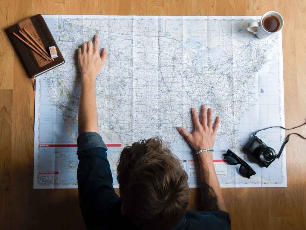
Your map is your adventure script. For beginners, start with:
- Maps
-
- 1:25,000 scale maps for detail
- Weatherproof map case
- Coverage beyond your planned route
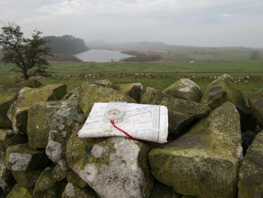
- Compass
Think of your compass as a translator between map and terrain. Essential parts:
- Magnetic needle
- Direction of travel arrow
- Rotating bezel
Learning Checkpoint: East Sussex Beginnings
In East Sussex with my Dad, we started with simple walks using an OS Explorer map. The key lesson? Understanding the map before stepping outside saved hours of confusion later.
Just as my journey progressed from Sussex fields to African bushland, let’s move from basic tools to understanding how to use them effectively.
Map Skills Development

From Paper to Reality: Understanding Map Language
Learning Checkpoint: First OS Map Experience
My Dad taught me to read a map like a story. Each symbol, line, and colour tells part of that story. This approach changed abstract symbols into real-world features.
Map Scale Mastery Understanding scale changes everything:
- 1:25,000 – One paper centimetre equals 250 ground metres
- 1:50,000 – Better for broader route planning
- 1:100,000 – Useful for route planning, less detail but wider view
Quick Practice: Compare the same area at different scales. Notice how features appear and disappear as you change scale.
Contour Lines and Terrain
A hard lesson from the Brecon Beacons: misreading contour lines led to an exhausting climb.
If you don’t spot the patterns in the contour lines, you can find yourself with unexpected challenges.
Remember:
- Close lines = steep terrain
- Wide spacing = gentle slopes
- Thick index contours show major height changes
Grid References
Military operations in Northern Ireland taught me the importance of precise location. If you end up in the wrong location at the wrong time, you could be in trouble!
The way to remember how to use grid references is this saying: “Along the corridor, up the stairs”.
This saying means you read the numbers that go along the map horizontally first (‘along the corridor’) and then the numbers, which go from top to bottom (‘up the stairs’).
Think of it like the game of ‘Battleships’ where you have to tell your opposition that you want to drop a shell on location ‘B7’ to see if you’ve hit their ship.
Grid references come in four types:
- Two-figure: Square kilometre – This shows the row or column on the map.
- Four-figure: Within one kilometre – This shows a single square on the map.
- Six-figure: Within 100 metres – This is when you break a single square into tenths to give a more exact location.
Just as night operations in Northern Ireland demanded different skills, let’s move to more advanced navigation techniques.
Advanced Navigation Techniques

Beyond the Basics: Military Experience
Night Navigation Mastery
Getting lost in Kenya taught me that darkness demands different skills:
- Preparation
- Study route features in daylight to help your brain memorise your route.
- Identify emergency markers to help get back on track if you veer off course.
- Calculate timings so you know when you should have reached a waypoint.
- Movement
- Use shorter legs – this makes your mistakes smaller.
- Trust your compass over instinct – your compass is rarely wrong (just don’t have anything magnetic nearby!)
- Follow obvious features – They help you keep on track easily.
- Maintain night vision – try not to use a torch. It ruins your night vision.
Weather Challenge Navigation
Low visibility on Dartmoor in Devon taught me crucial lessons:
- Fog/Mist Navigation
- Exact compass work is essential when you can’t see landmarks in the distance
- Regular position checks – don’t guess your position. Check it often to minimise getting lost.
- Use collecting features
- Rain and Wind Adaptations
- Map protection – rain can destroy your map. Get a waterproof case for it.
- Modified walking patterns – avoid steep edges and exposed locations.
- Route adjustments – be prepared with a different route in bad weather.
From Welsh mountains to African rainforests, each environment demands unique approaches.
Specialised Navigation

Every Landscape Has Its Story
From Sussex downs to Sahara sands, each terrain demands unique techniques. Here’s what different environments taught me:
Forest Navigation:
Kenyan Rain Forest Lessons
Dense woodland creates specific challenges:
- Use catching features (streams, paths)
- Maintain strict compass discipline and navigate from tree to tree, if necessary
- Read vegetation changes
Quick Practice: Next time you’re in woodland, try identifying three different types of natural navigation markers.
Mountain Navigation:
Washington State Experience
Mountain terrain demands respect:
- Altitude Considerations
- Weather effects at height – you’ll notice how much cooler it is the higher you go
- Energy management – keep it steady as you climb up.
- Escape route planning – If the weather changes for the worse, how will you get off the top safely?
- Ridge and Valley Navigation
- Using spurs and re-entrants – These are ideal features to locate yourself on the map.
- Safe route selection – Study the terrain in detail before you set off to check for cliffs and steep terrain.
- River crossing points – Crossing rivers can be dangerous. Check for safe points where the water is likely to be slow-moving and shallow.
Desert Navigation:
Kenya’s Harsh Lessons
The desert brings unique challenges:
- Subtle terrain changes matter – You need to pay even more attention to the terrain when it all looks so similar.
- Watch for wind-formed features – If there is a prevailing wind, take note of its direction and use it to help you navigate.
- Manage heat haze effects – Remember to trust your map and compass and not believe, and not the mirage.
- Adjust distance calculations – In wide open spaces, it’s easy to underestimate distances.
Rainforest Navigation:
Cameroon Insights
Dense vegetation requires:
- Careful compass work – Unless you’re following a marked track, use your compass a lot through forests and woodland.
- Canopy reading skills – Look for gaps in the canopy to check where the sun is in the sky to get a rough idea of your direction.
- Modified distance estimation – You travel more slowly through forests. Don’t overestimate how far you can cover.
While these traditional skills remain crucial, modern technology offers new possibilities.
Modern Integration

From Paper Maps to Pixels
Learning Checkpoint: African Expeditions
Technology limitations in remote areas taught me valuable lessons about combining old and new:
Essential Digital Tools:
- GPS Devices
- Dedicated units vs phones – Smartphones are great, but their battery lives tend to be limited. Dedicated GPS devices mean you can save your phone’s battery power.
- Battery life – Cold weather makes batteries last less, so make sure you have power banks that you can carry around, or use them less.
- Durability considerations – Smartphones are always as tough as dedicated GPS devices.
- Backup systems – Always carry a map and compass. They don’t need batteries!
- Navigation Apps
- Recommended options:
- OS Maps – For the UK, this is my personal favourite. The OS Maps is awesome because of its detail and accuracy.
- OutdorActive – Formerly ViewRnager, OutdoorActive is great for internal navigation
- Gaia GPS – Great for North American routes.
- AllTrails – Another great app for finding and navigating routes in different parts of the world.
- Recommended options:
Selection Criteria:
Before you choose what’s right for you, go through this checklist to help narrow down your options:
- Offline ability – Will it work with just a GPS connection?
- Battery efficiency – How will you be off the grid?
- Map quality – How detailed are the maps for the route I plan to take?
- Interface usability – How easy is it to use and to learn to use?
Hybrid Navigation Techniques
Mixing my ‘old school’ military skills with modern tech taught me to combine methods:
- Primary Navigation
- Digital for precision – There’s no doubt it, digital devices are brilliant for pinpointing your location.
- Traditional backup – But, don’t rely on digital alone. Learn to use a map and compass, too. They won’t let you down.
- Regular cross-checking – If you run out of battery, it’s good to have your recent locations noted on the paper map.
- Safety Considerations
- Battery management – The longer the route, the more battery power you’ll need. Think carefully about what you’ll need.
- Signal limitations – You’re likely to be away from civilisation, so to speak. Don’t expect great phone and data signals, and the limitations to communications that brings.
- Weather effects – Weather changes fast in hills and mountains. Take it into account when planning your journey.
- Equipment protection – Mobile phones aren’t that tough without a case. Paper maps need a case to protect them. Simple precautions will make it safer.
Future Developments: Navigating Tomorrow’s Terrain

The landscape of navigation technology changes rapidly. But my experience in Africa taught me an invaluable lesson: always keep traditional skills as your foundation.
Here’s how emerging technologies are shaping navigation’s future:
Augmented Reality Navigation Current Developments:
- Real-time terrain overlay
- Virtual waypoint markers
- Live feature identification
- 3D terrain visualisation
Practical Applications:
- Route preview before hiking
- Real-time risk identification
- Interactive terrain analysis
- Visual navigation aids
AI-Powered Route Planning Smart Features:
- Terrain difficulty assessment
- Weather-aware route suggestions
- Energy expenditure calculation
- Group capability matching
Real-world Integration:
- Dynamic route adjustment
- Safety corridor planning
- Alternative route suggestions
- Experience-based recommendations
Advanced weather integration Modern Capabilities:
- Micro-climate prediction
- Route-specific forecasts
- Real-time weather alerts
- Terrain-weather interaction model
Practical Uses:
- Storm avoidance routing
- Wind exposure assessment
- Precipitation impact planning
- Temperature variation mapping
Risk Assessment Tools Emerging Features:
- Real-time risk monitoring
- Group capability assessment
- Equipment requirement analysis
- Emergency response integration
Safety Applications:
- Dynamic risk evaluation
- Automated safety checks
- Emergency service integration
- Group monitoring systems
Remember: Technology should enhance, not replace, your core navigation skills. Just as my GPS would have helped in that Kenyan bush at night, your future success depends on maintaining a strong foundation in traditional navigation while embracing new tools thoughtfully.
Final Learning Checkpoint: Remember my first lesson in Kenya? Getting lost taught me that no single method is foolproof.
The best navigators combine:
- Solid traditional skills
- Modern technology
- Environmental awareness
- Continuous learning
Bringing It All Together: From Lost to Found

My journey from those first walks in Sussex to navigating African rainforests taught me that navigation is more than just reading maps or following a GPS. It’s about building confidence through understanding.
Key Takeaways:
- Start with Basics Remember that night in Kenya when all my fancy gear couldn’t help? Basic skills form your foundation:
- Map reading
- Compass use
- Distance estimation
- Terrain interpretation
- Build Progressive Skills Like my journey from Army training to real operations showed:
- Start in familiar areas
- Gradually increase challenge
- Practice in various conditions
- Learn from mistakes
- Adapt to Your Environment Whether you’re in:
- The Lake District’s mountains
- Forest of Bowland’s hills
- Brecon Beacons’ fog
- Urban landscapes Each environment teaches new lessons.
- Combine Old and New Just as military operations evolved:
- Master traditional skills first
- Add technology thoughtfully
- Maintain both skill sets
- Practice hybrid techniques
Final Learning Checkpoint: Getting Started
Begin your journey:
- Get a local area map
- Learn basic compass skills
- Practice in safe environments
- Join a navigation group
- Build experience gradually
Remember, every expert navigator started as a beginner. My Dad teaching me in Sussex led to leading teams through African rain forests. Your journey starts with a single step – or in this case, a single map.
Your Next Steps:
- Purchase basic equipment
- Practice close to home
- Join local walking groups
- Take navigation courses
- Share your experiences
The most important lesson? Trust the process. Navigation skills build naturally when you combine knowledge with practice. Start small, stay safe, and keep learning.